 Česká verze
About the Platform
The simulations of the C sequestration potential are founded on the regional crop model EPIC-IIASA, which was developed for simulating agricultural crop growth and production across global, continental, and sub-continental scales. The platform’s core is the process-based EPIC (Environmental Policy Integrated Climate) model, which integrates several modules for simulating crop growth, soil water balance, and nutrient balance (C, N, and P cycle and transformations in soil and plant). The validated and widely used CENTURY soil organic matter dynamics model is incorporated into EPIC. Furthermore, the EPIC model is supplemented by a rich selection of agrotechnical measures.
Selected Simulation Options of the EPIC Model
| Crops | annual / perennial, fodder crops, root crops, etc., including cultivar properties (e.g., earliness) |
| Crop rotation | monoculture / crop rotation |
| Mineral fertilizers | N application rate, method of application (specific date / application based on crop needs) |
| Organic fertilizers | quantity and type according to composition and origin (farmyard manure, sewage sludge, compost, etc.) |
| Irrigation | without / with irrigation, possibility to limit the maximum daily and total annual irrigation volume |
| Soil cultivation | tillage depth and character (plow, discs, harrows, etc.), conventional / reduced / no-till farming |
| Catch crops | without / with catch crop (N-fixing / non-fixing) |
| Residue management | crop residues completely / partially removed from the field |
Crop growth dynamics are simulated in a daily step simultaneously for a large number of separate, spatially localized sites, typically over a time horizon ranging from several years to decades. EPIC-IIASA provides output data detailing the temporal and spatial change in crop production in response to recorded (historical) or assumed (future, alternative) influencing factors. These factors include: weather, topography, soil and its management, agrotechnical practices, and crop and cultivar properties
EPIC-IIASA model – elements, structure and functionality
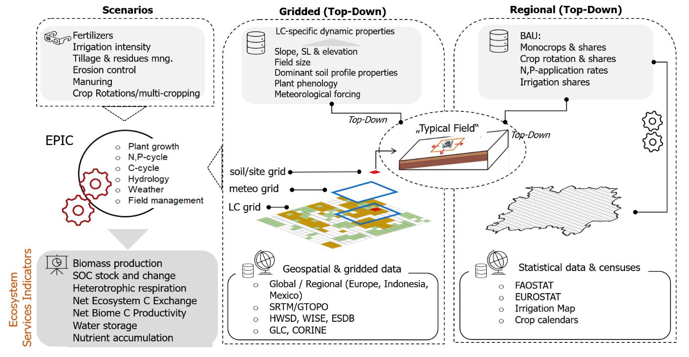
A part of the platform is the geospatial data infrastructure, which ensures spatially represented inputs for the EPIC model (weather, location, geomorphology, soil, crop, nutrient inputs, and land management).
Scenarios constitute a another element of the platform, serving to formulate specific research questions tailored to the intended purpose. They directly influence the selection of outputs and are typically defined by utilizing alternative input data concerning the climate (e.g., historical records or future climate projections) and land management (e.g., adaptation and mitigation measures such as carbon farming).
The EPIC-IIASA model has been validated as a robust tool for assessing the impacts of climate change, both when used individually and as part of model ensembles. Its reliability has also been demonstrated within integrated modeling systems.
EPIC-IIASA platform was modified for regional studies of agroecosystems in the Czech Republic, specifically to assess the C sequestration potential and to propose and verify the effectiveness of C sequestration model systems in agricultural soil. We developed the national geospatial data infrastructure EPIC-IIASA CZ. This infrastructure comprises 977 spatial Simulation Units (SimU), generated by dividing districts according to the climatic region and prevailing soil properties (depth, soil type, and humus content class). Each SimU was assigned a typical soil profile, daily weather data from the years 1989–2019 derived from 10 km grid, and estimated sowing and harvesting dates for main crops based on the respective production area.
The infrastructure’s design facilitates the aggregation of outputs to the LAU1 (districts) and NUTS2 (regions) level, meeting the administration’s requirements for result quantification and interpretation. The entire infrastructure was programmed in the LINUX environment.